Recognizing the agency’s best practices in mapping and geospatial information management, the Commission on Audit (COA) collaborated with NAMRIA for an information sharing activity held at the NAMRIA Lecture Hall on 05 March 2020. The event included presentations on various geospatial technologies used by the agency in its map making and data management procedures. It was participated in by senior officials and staff from the two government agencies.
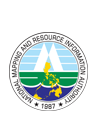
In his message, NAMRIA Administrator, Usec. Peter N. Tiangco, PhD extended his appreciation to the COA for identifying the agency as a partner institution in their plans to leverage geospatial technologies for audit and report generation. He noted that NAMRIA has been providing technical assistances and geographic information system (GIS) trainings to various government agencies. These, alongside the collaborations made, have allowed the agency to advocate the use of geospatial information and services in local and national planning and development efforts.
NAMRIA Administrator Tiangco and COA Chairperson Aguinaldo jointly discuss the possible assistances from NAMRIA.
-- VENER QUINTIN C. TAGUBA, JR.
The objective of promoting the use of geospatial information in the government, particularly for project monitoring and validation activities was affirmed by COA Chairperson, Atty. Michael G. Aguinaldo. He said that the wealth of information and best practices from NAMRIA and other technical agencies can help COA further improve their auditing works.
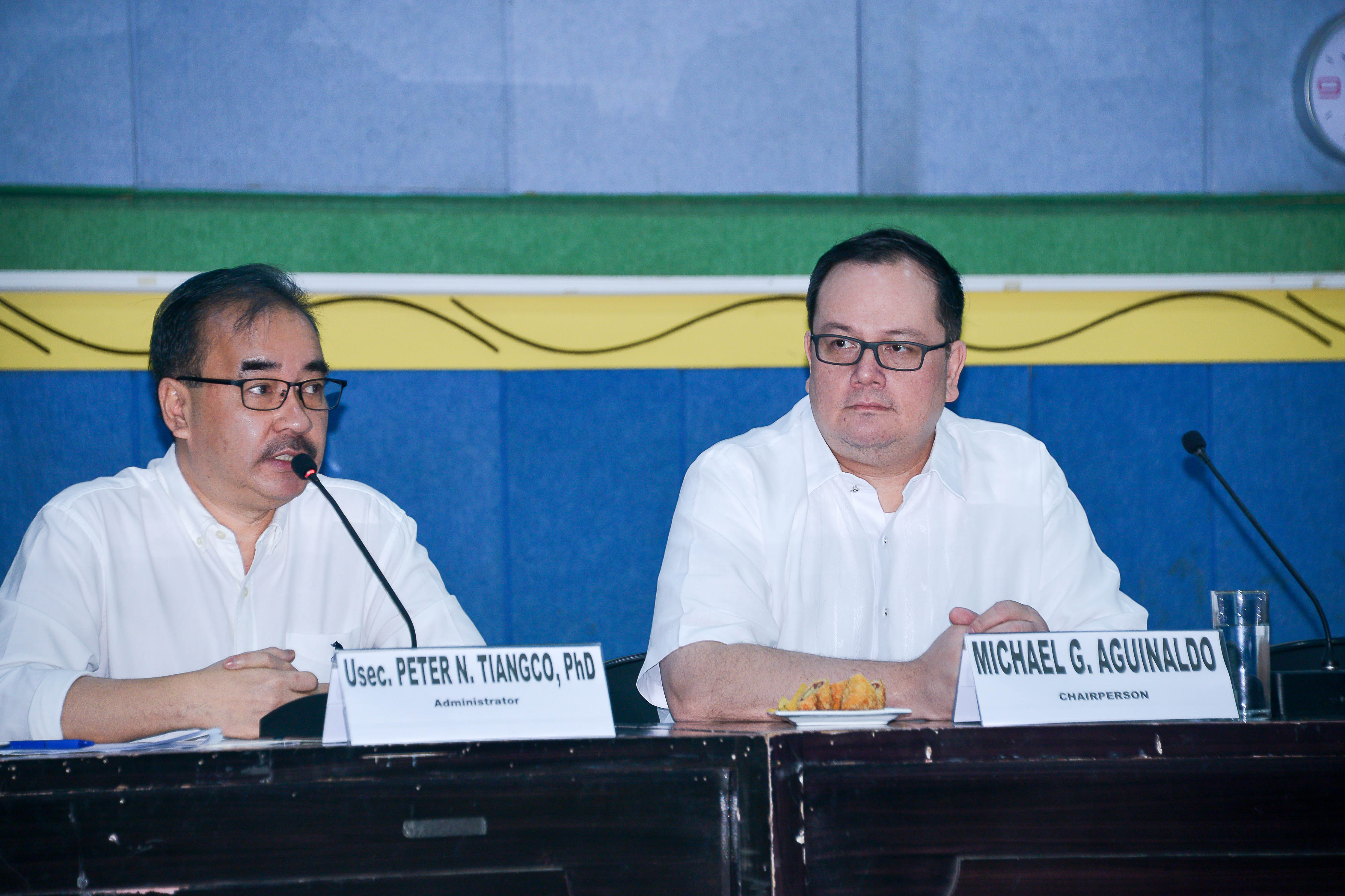
COA Director Cabochan reports on the database used by the Commission in project monitoring and validation works.
-- VENER QUINTIN C. TAGUBA, JR.
The messages were followed by a series of technology presentations. Assistant Director Benjamin P. Balais of the Geospatial Information System Management Branch (GISMB) presented the tools and technological products used by NAMRIA. These include remote sensing, drone/unmanned aerial vehicle, global positioning system, GIS, and Google Earth. Using actual datasets, he discussed how these specific applications can enhance monitoring and validation of reported government projects. GISMB Application Developer Melvin O. Perez then introduced the Geoportal Philippines, a common data infrastructure that advocates the use of standard multiscale basemaps. Both of the presentations were made interactive by a demo-simulation of the tools using data from actual projects. The updated audio-visual presentation of NAMRIA was shown during the program. The event culminated with a tour of the NAMRIA Museum of Surveying and Mapping.
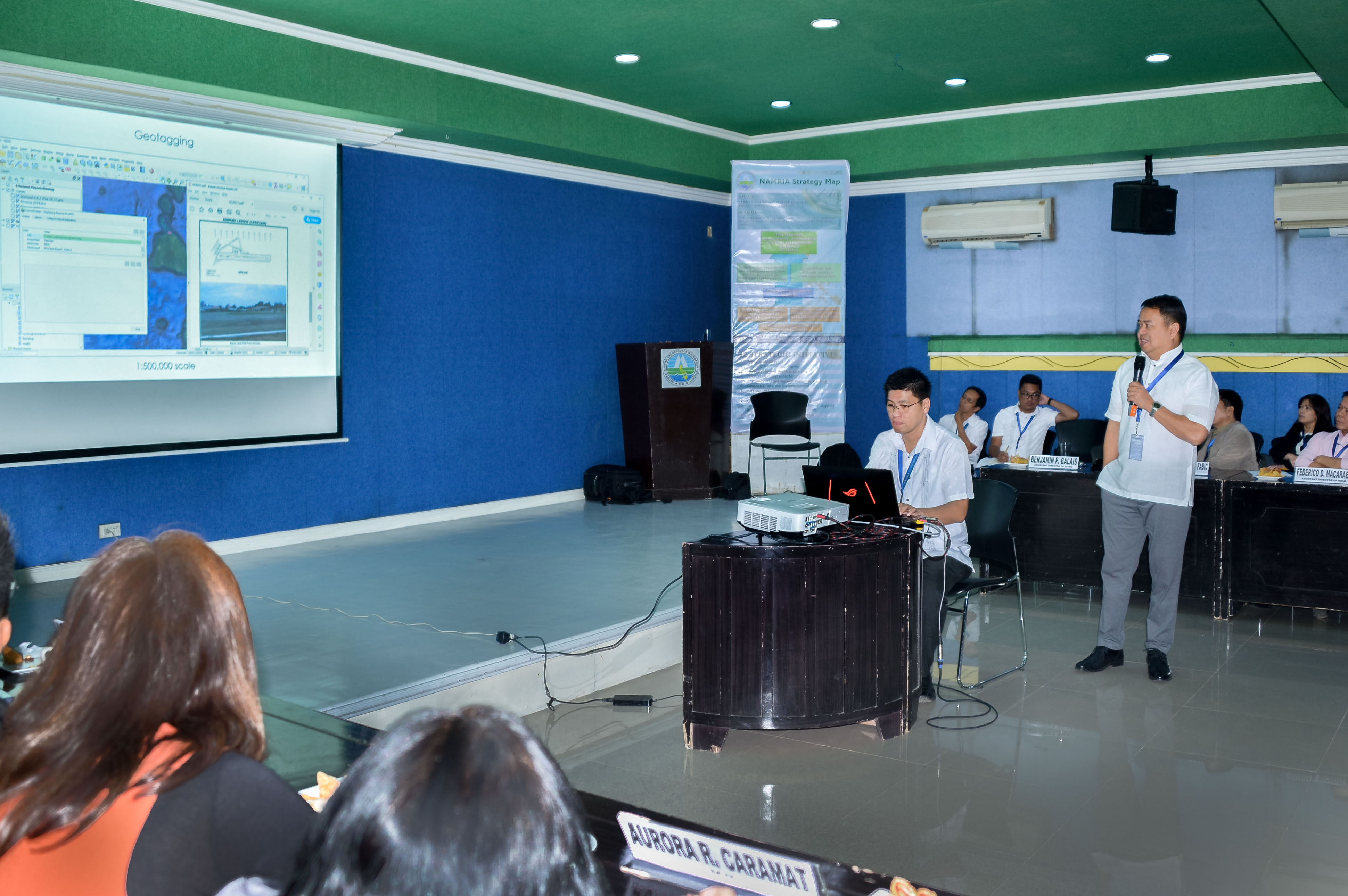
Assistant Director Balais, together with Mr. Marlon Mariñas of GISMB, presents actual datasets from the
DENR's National Greening Program. -- VENER QUINTIN C. TAGUBA, JR.
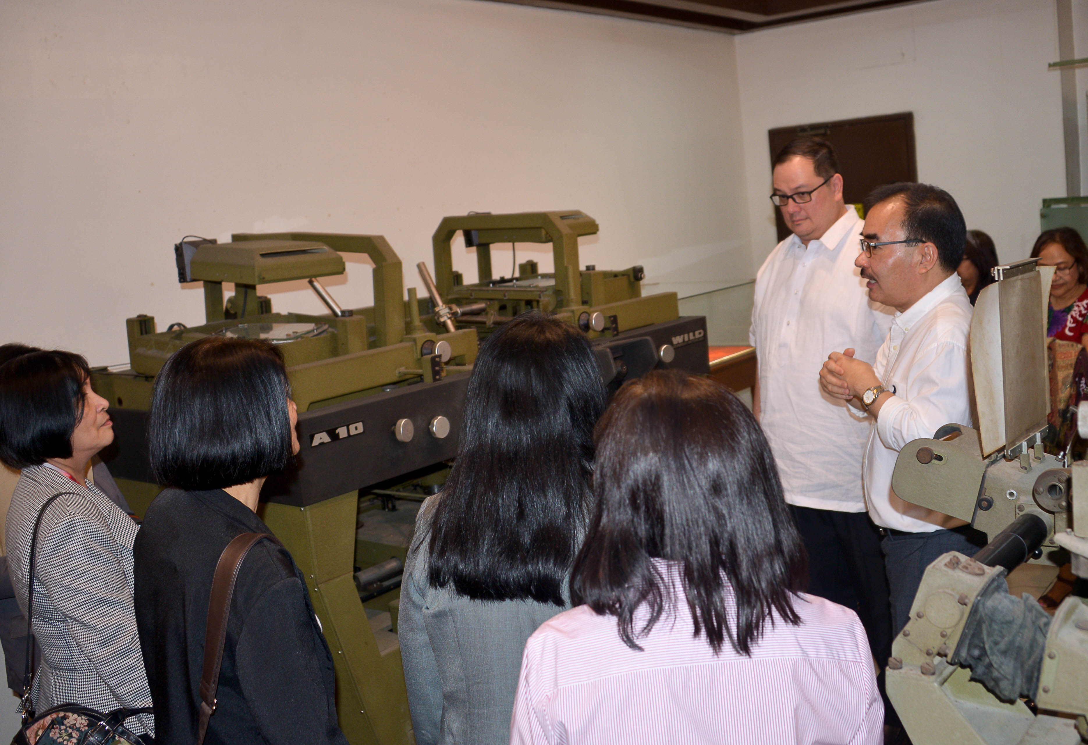
Administrator Tiangco explains how the old surveying equipment displayed at the NAMRIA Museum work.
-- VENER QUINTIN C. TAGUBA, JR.
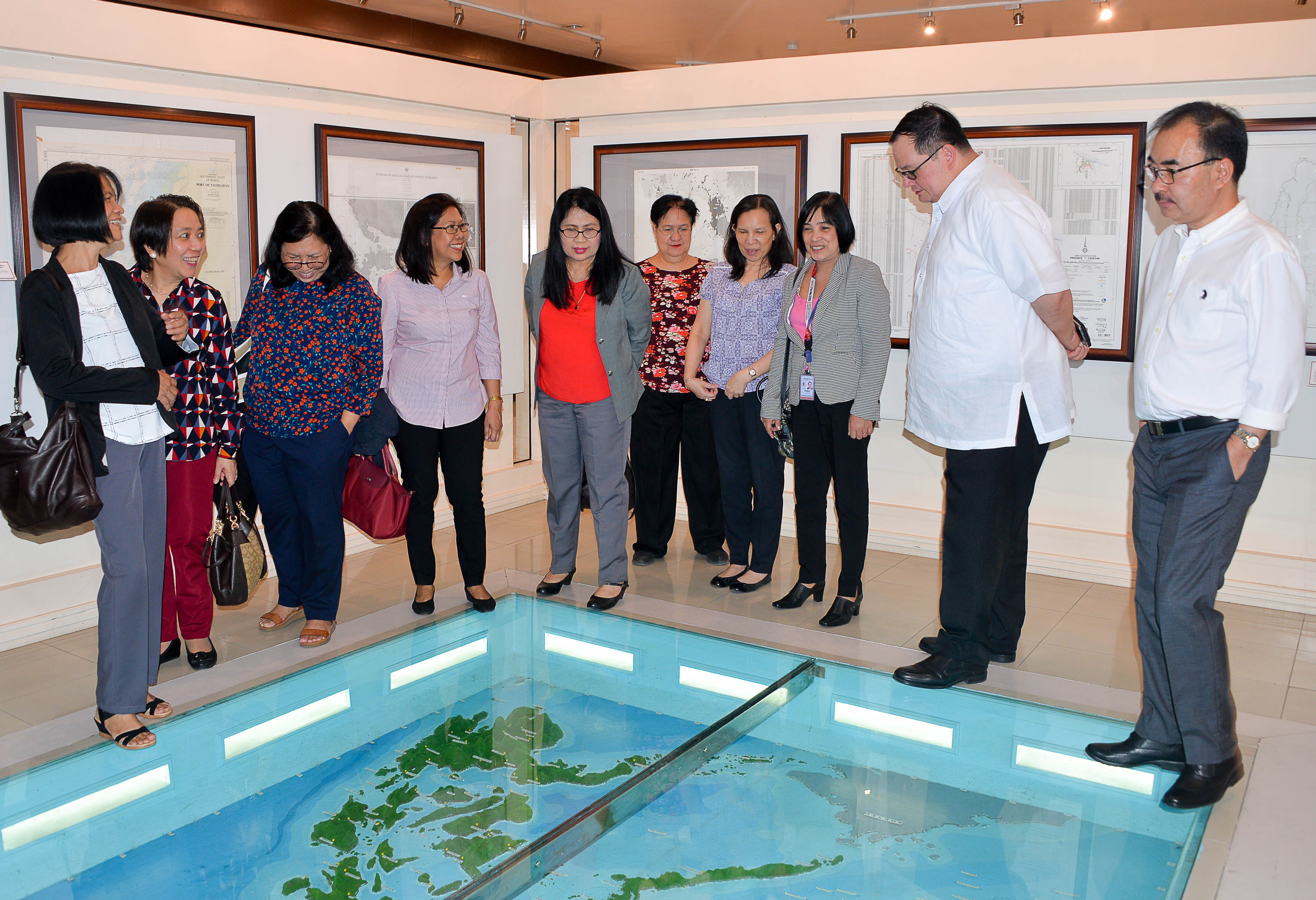
COA officials led by Chairperson Aguinaldo are shown the Philippine relief map at the NAMRIA Museum
by Administrator Tiangco and MGB Assistant Director Castro (fourth from right). -- VENER QUINTIN C. TAGUBA, JR.
As a result of the information sharing, the COA will embark on technical cooperation with NAMRIA through a Memorandum of Agreement. In addition, selected COA personnel will undergo GIS trainings at the NAMRIA Geomatics Training Center. The details for these activities will be discussed at a later date.
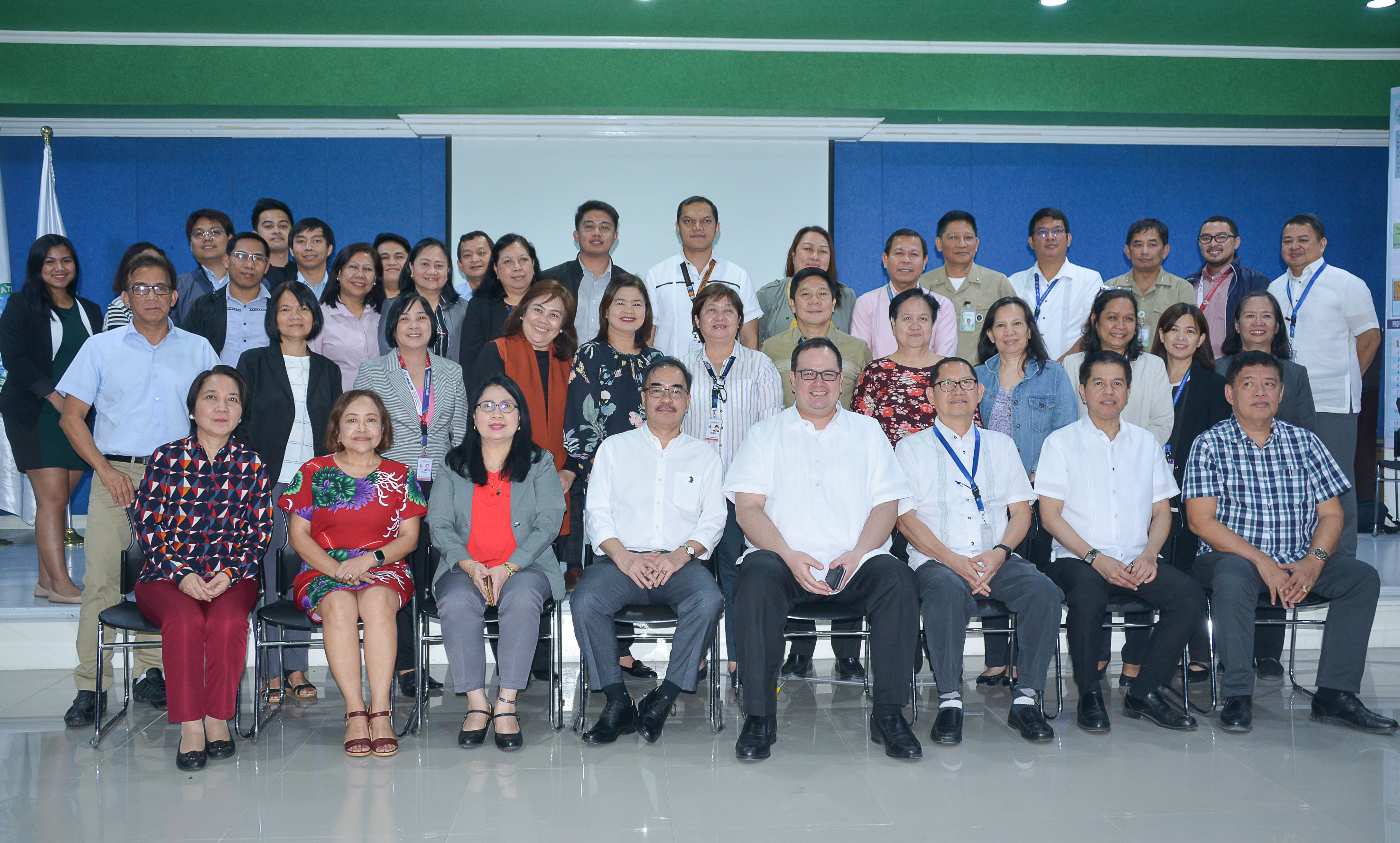
NAMRIA and COA officials, together with support staff, pose for a souvenir picture. -- VENER QUINTIN C. TAGUBA, JR.
The COA contingent consisted of Assistant Commissioner Winnie Rose H. Encallado; Directors Lorna D. Cabochan, Marlon R. Marquina, Maribeth F. De Jesus, Ma. Luisa P. Inguillo, Michael L. Racelis, and Gloria D. Silverio; State Auditors Menardo B. Sanduco, Marites D. Odtojan, Cecila G. Raneces, Aurora R. Caramat, Amalia P. Manabat, Lea C. Bernardino, Jeremy A. Maceda, Policarpio L. Silva, Jr., Mark Anthony G. Cabuco, Leona A. Andriano and Reneson S. Evangelista; Information Technology Officers Gerald M. Mendeja, Amelita A. Jacinto, Augustine A. Perez, and John Robin B. Paris; and Training Specialist Corinne Beatrice DR. Mendoza.
Other NAMRIA senior officials in attendance during the event were: Deputy Administrators Jose C. Cabanayan, Jr. and Efren P. Carandang, Chief of Staff Rowena E. Bongalos, Mapping and Geodesy Branch Director Ruel DM. Belen and Assistant Director Ofelia T. Castro, Hydrography Branch Officer in Charge (OIC) Director Antonio G. Valenzuela, Jr. and OIC Assistant Director John M. Ladindalawa, GISMB Director John Santiago F. Fabic and Assistant Director Benjamin P. Balais, Support Services Branch Director Febrina E. Damaso, and Resource Data Analysis Branch Assistant Director Federico D. Macaraeg.
Readers can email
newscoop@namria.gov.ph or fax letters to +63-2 8884-2855 for their comments and suggestions.
 SHOP
SHOP


 LOCATE
 DOWNLOAD
 LEARN
LEARN